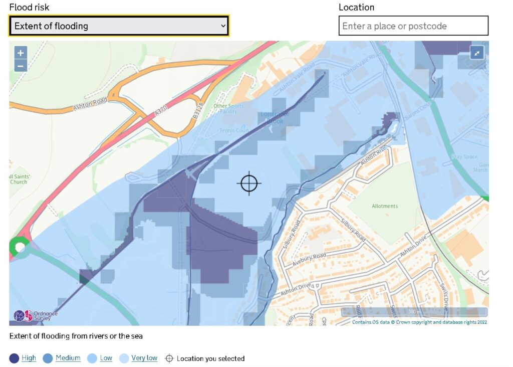
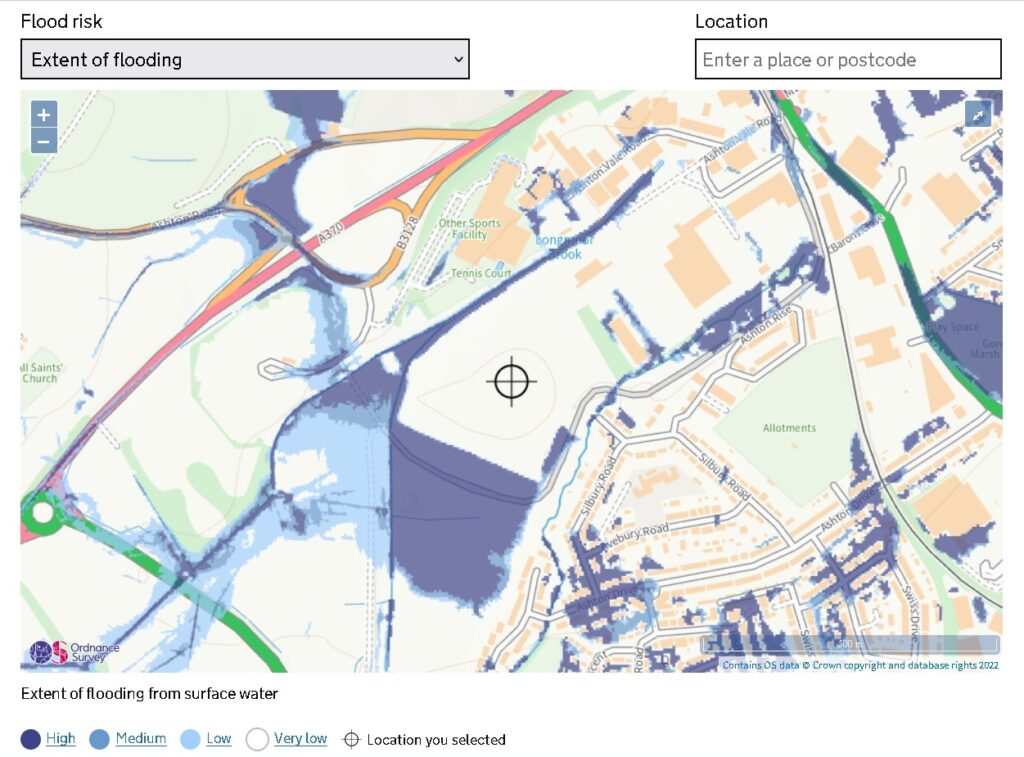
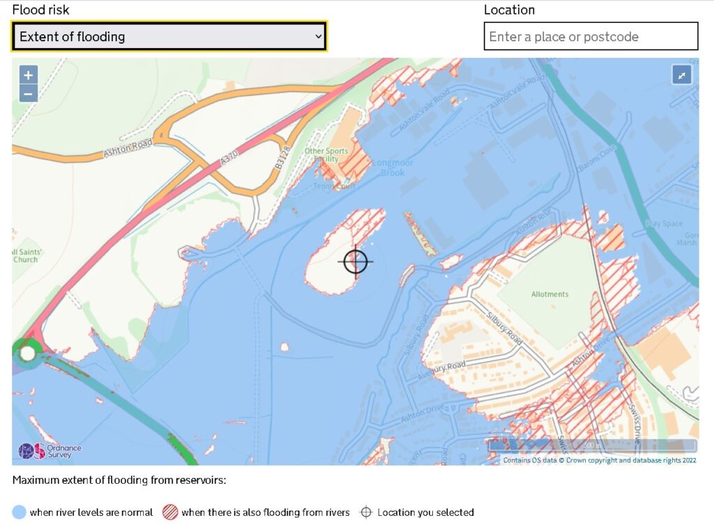
In short, the proposed site is at risk of flooding. This is why the environment agency kept objecting to this development.
But did you know there are many different types of flooding?
You can check them all here on the government flood risk website. A postcode to get close to the proposed site is BS3 2QB.
When you get there you notice all the different possible types of flooding in the drop-down menu:
Flood risk from rivers or the sea
– Extent of flooding
– Depth and flow estimates at monitoring stations
Flood risk from surface water
– Extent of flooding
– High / Medium and Low risk – Depth and Velocity
Flood risk from reservoirs
– Extent of flooding
Let’s look at the headlines images (and again check them all for yourselves using the link above) – the extent of flood risk from 1. rivers or the sea, 2. surface water and 3. reservoirs

Extent of flooding from surface water


What seems clear is that the proposed site is at risk of multiple types of flooding.
Now, granted, it seems very unlikely that the reservoirs out towards the airport are going to overspill (fingers crossed). But, apparently, if the Barrow Tanks, fail or overflow, then the area of land designated to be inundated with water includes this site.
However, as we all enter a period where we know more extreme weather events like flooding are going to become increasingly more likely – why are we proposing to build new homes on land at risk of multiple different types of flooding?
Please consider taking action to help Save the Ashton Vale Environment.
